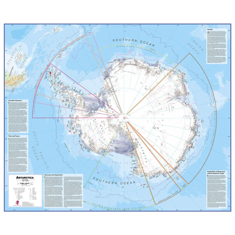
This wall art is a continental map and would not be complete without this political Antarctica map. Our Antarctica map includes information from the British Antarctic survey on scientific research. Information on Antarctica's climate and resources is included and as you would expect with a political map, the territory divisions are shown. Shown also are the major expedition routes, camps and weather stations on Antarctica. The map features hill shading, also contains information on the flora and fauna of Antarctica. Provides a great opportunity to learn more about a continent that many of us will never visit. Ideal for classrooms or those with an interest in the South Pole and surrounding areas. This large Antarctica wall map political (laminated) with encapsulation gives the map a write-on, wipe off finish. Using a dry wipe marker, any writing on the map can be wiped off with a proprietary cleaner.


 18+, T&C apply, Credit subject to status.Learn more